Wayfinders: Waves Winds and Stars
The 5,000-year story of voyaging in the Pacific
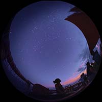 Across the ocean, where the sky meets the sea, most people only saw the horizon. But, the wayfinder could see and feel far more.
Wayfinders opens by telling the story of the spread of people out of Southeast Asia throughout the Pacific over thousands of years. They discovered thousands of islands and learned to move between them using only the signs of the natural world around them, including the stars. Eventually they reached the islands of Hawai'i and sailed vast distances back and forth from other islands. Around 600 years ago these long ocean crossing voyages to and from Hawai'i had all but stopped as the populations became self-sustaining. The knowledge and skill built over thousands of years faded from cultural memory into only legends and stories.
Fast forward to the 1970’s, when the Hawaiian Cultural Renaissance was building after nearly 200 years of suppression by colonial powers. It was at this time that the Polynesian Voyaging Society was founded by native Hawaiian artist Herb Kane, sailor Tommy Holmes, and anthropologist Ben Finney in 1973. They designed and built a replica double-hulled canoe in the spirit of those used hundreds of years before. Their intention was to sail it to Tahiti and back in the wake of their ancestors, without modern navigation instrumentation. They named their wa'a (canoe) Hōkūle'a after the star of joy, also known as Arcturus. They asked Mau Piailug of the island of Satawal in Micronesia to be their navigator and he agreed, recognizing that the traditional art of wayfinding was in danger of disappearing entirely. In 1976, he successfully navigated Hōkūle'a across 2,600 miles, from Hawai'i to Tahiti without using modern instruments.
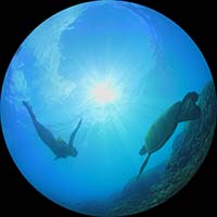 A young Hawaiian named Nainoa Thompson was particularly inspired by this accomplishment and convinced Mau to return to Hawai'i to share his wayfinding knowledge. Nainoa spent countless hours with Mau in the late 1970s studying the movement of the stars and learning to read the waves to get from Hawai'i to Tahiti and back. Mau shared with Nainoa his star compass based on the rising and setting stars in his region of Micronesia. Nainoa adapted this to create his own Hawaiian Star Compass that would work in any part of the vast Pacific. The horizon is broken into 32 equal sections called houses. The east and west portions mirror each other. Using the star compass, it is possible to determine direction by memorizing the houses in which particular stars rise and then set. In 1980, Nainoa became the first Hawaiian in 600 years to navigate to Tahiti in the traditional way.
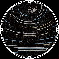 Later, University of Hawai'i scholars and the Polynesian Voyaging Society would develop the Hawaiian Star Families. These families divide the sky into four segments connecting stars north to south. Three of the four can be seen throughout the course of a night at any time of year. By memorizing the stars in each family and their relation to each other, a navigator can find the positions of all the other stars, even when part of the sky is obscured by clouds. Over the next several decades, the Polynesian Voyaging Society sailed to all corners of the Polynesian Triangle, visiting Aoteroa (New Zealand) and Rapa Nui (Easter Island) and many other islands in between. Hōkūle'a’s voyages renewed a sense of pride in the Hawaiian people and reconnected the islands and people of Polynesia.
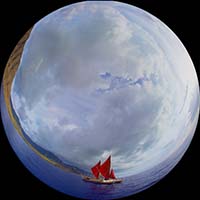 The video stands on its own as a 25-minute show. Integrating four live, instructor-led elements (included in the script) can immerse the audience in an interactive learning experience. The first two live segments build to the third: a virtual trip from Hawai'i to Tahiti and back with the audience determining when they have returned to Hawai'i.
Wayfinders was produced in Hawai'i by Bishop Museum and 1001 Stories in collaboration with the Polynesian Voyaging Society.

Running time: 24:03
Suitable for: General Public
Information about: Celestial navigation, Hawaiian and Polynesian history
Year of production: 2014
Don't see the language you want? Let's work together with the producer to create it. Read more here!


